Samuel Beckett Defaced

Knowing we were in for heavy rain this afternoon, Jackie ventured out on this drizzly morning to tackle the storm damage. The idea was that she would free what she could from the entanglements of the fallen tree, then call me to lift it. She seemed to be taking quite a long time, so I wandered out to join her.

She had freed the baskets from beneath the tree which she had hoisted out of the West Bed, and unravelled the still rooted solanum from the trunk

which she had dragged onto the back drive path.

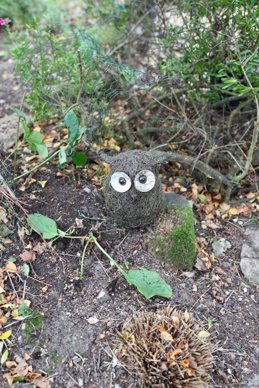
The wicker owl, sans nose, perched on a low stump,

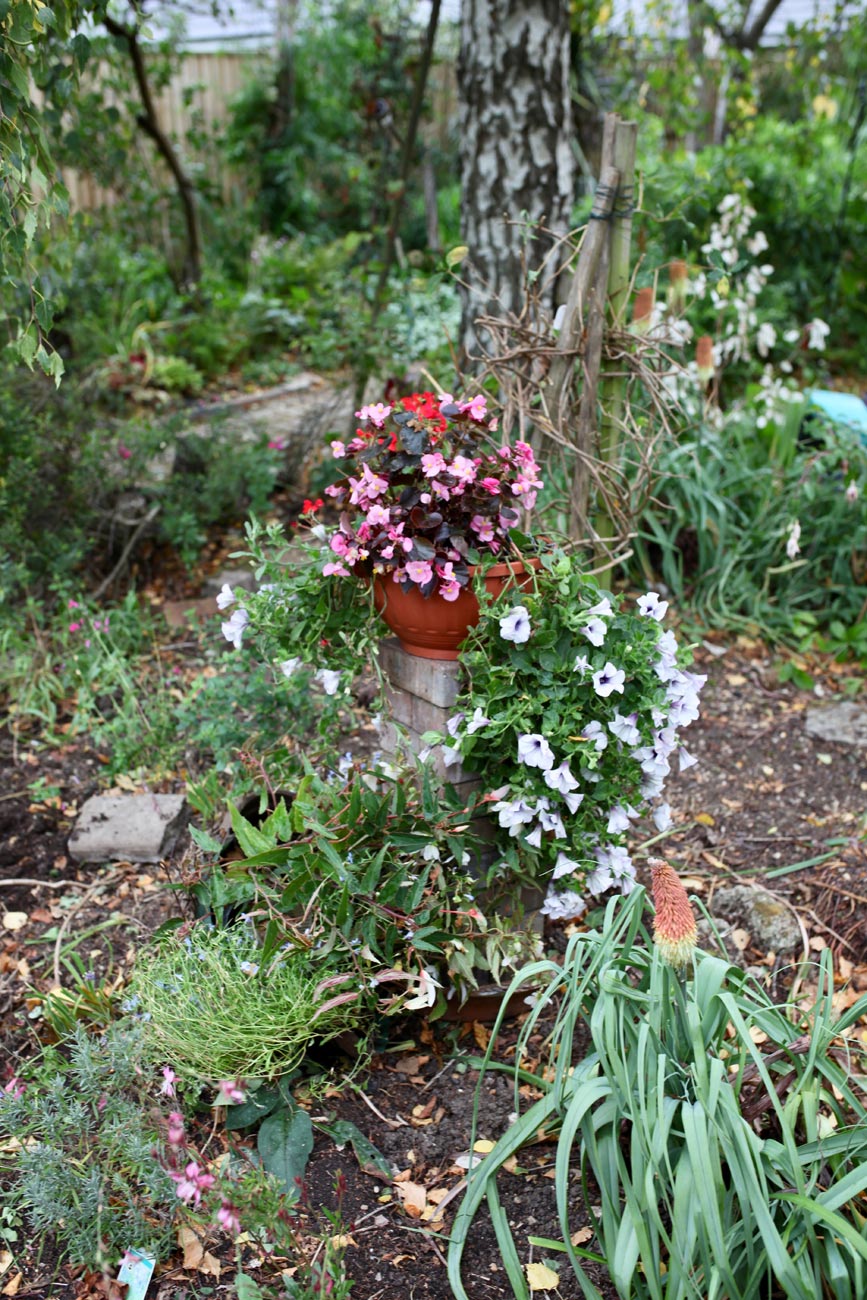
and the hanging baskets found a temporary home on a brick pillar in the recently thinned out Weeping Birch Bed.

The fallen hydrangea terra cotta pot had been righted.

While I surveyed the Head Gardener’s efforts, she furnished the owl with a new beak.

Elizabeth soon came out to lend a hand, which was used to retie the rose Summer Wine.

Jackie had gathered up many fallen branches to add to the few I plucked yesterday. My sister continued until lunchtime when she dripped indoors having cleared the rest.
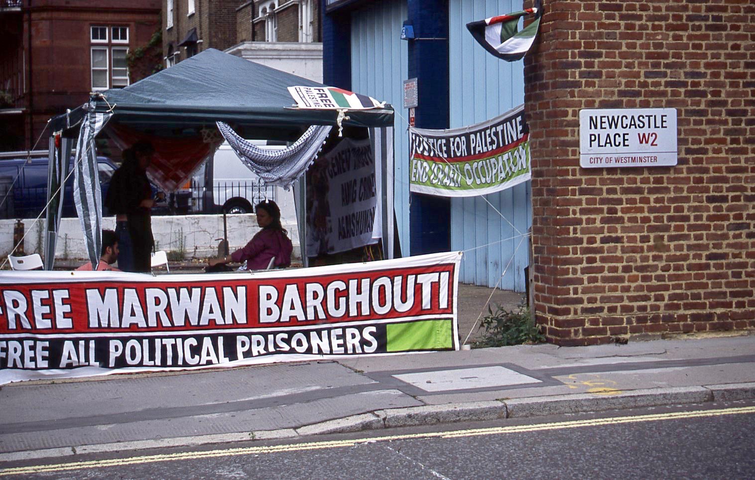
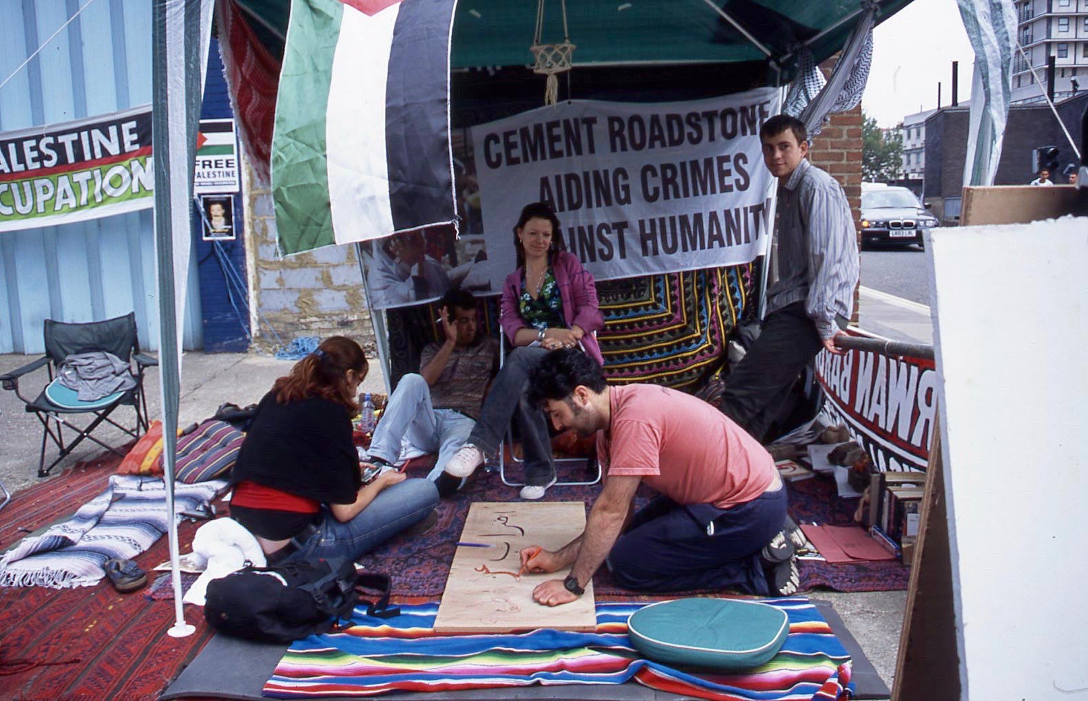
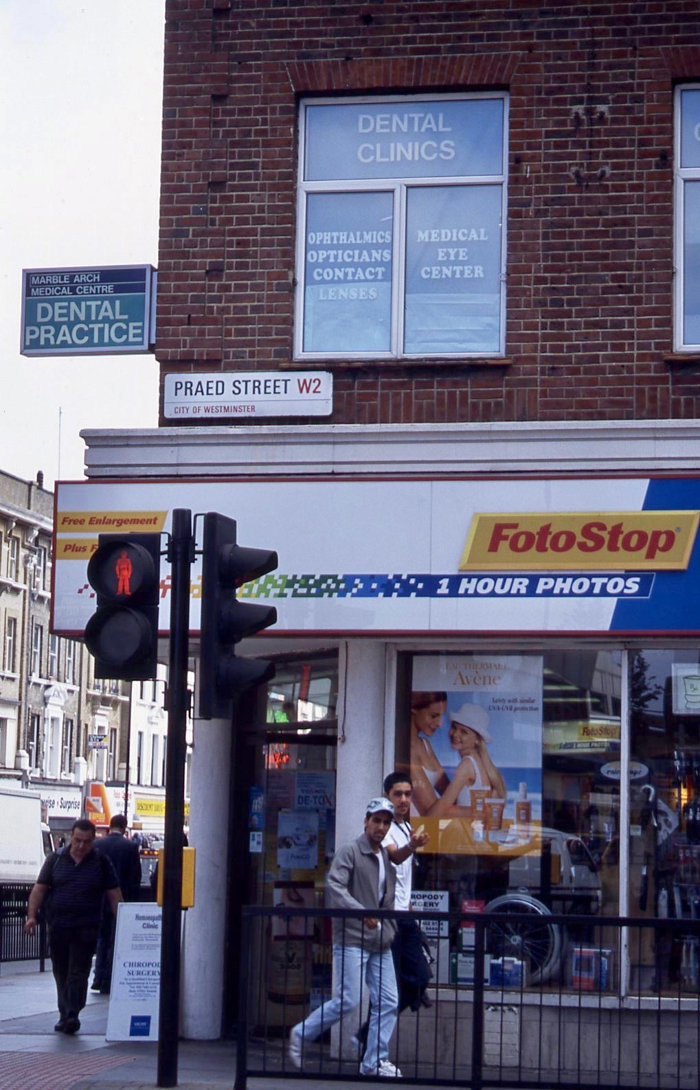
As the rain hammered down this afternoon, I took a virtual reality tour of the Streets of London, scanning a baker’s dozen of images from colour slides of May 2008.

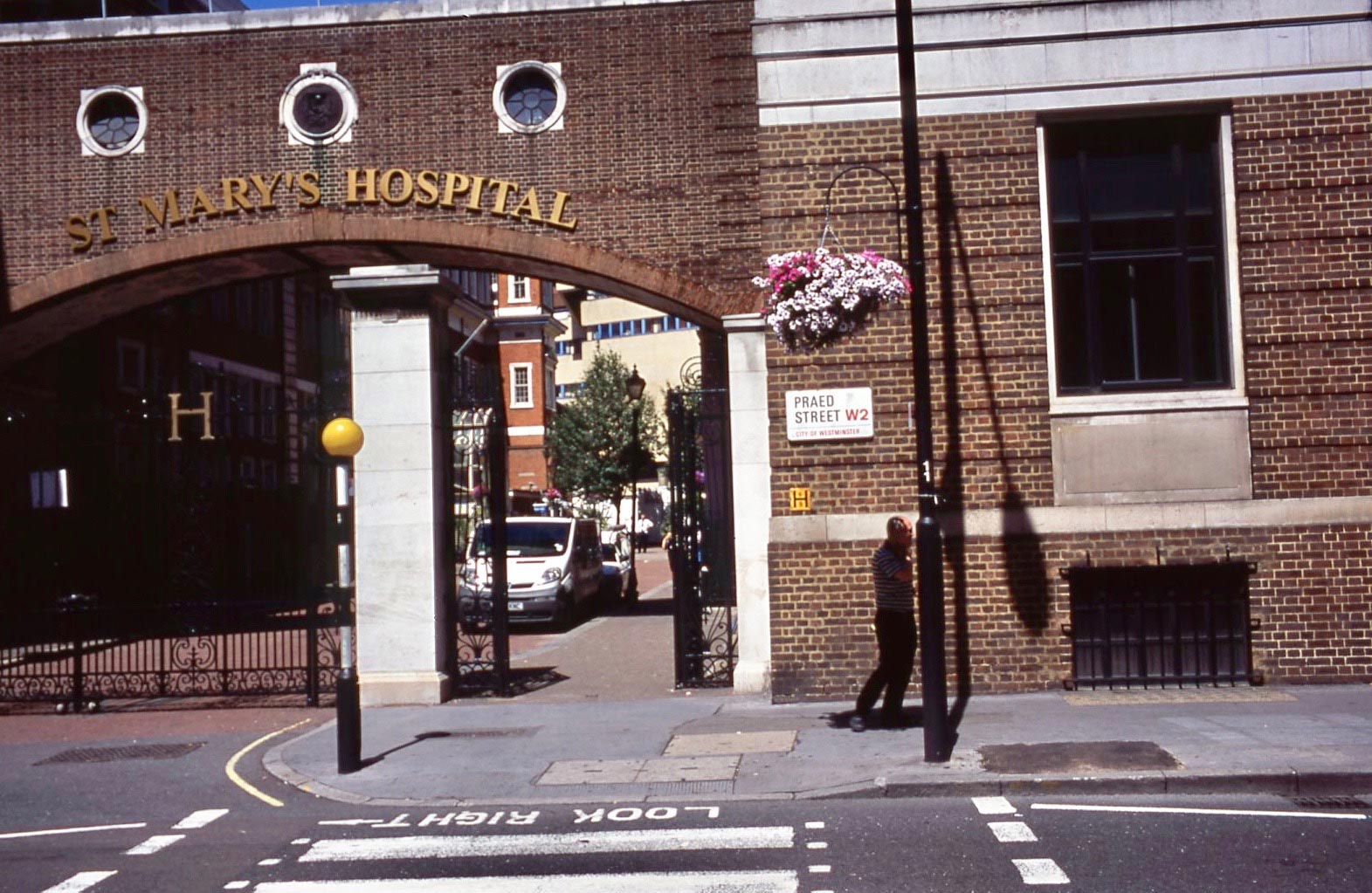
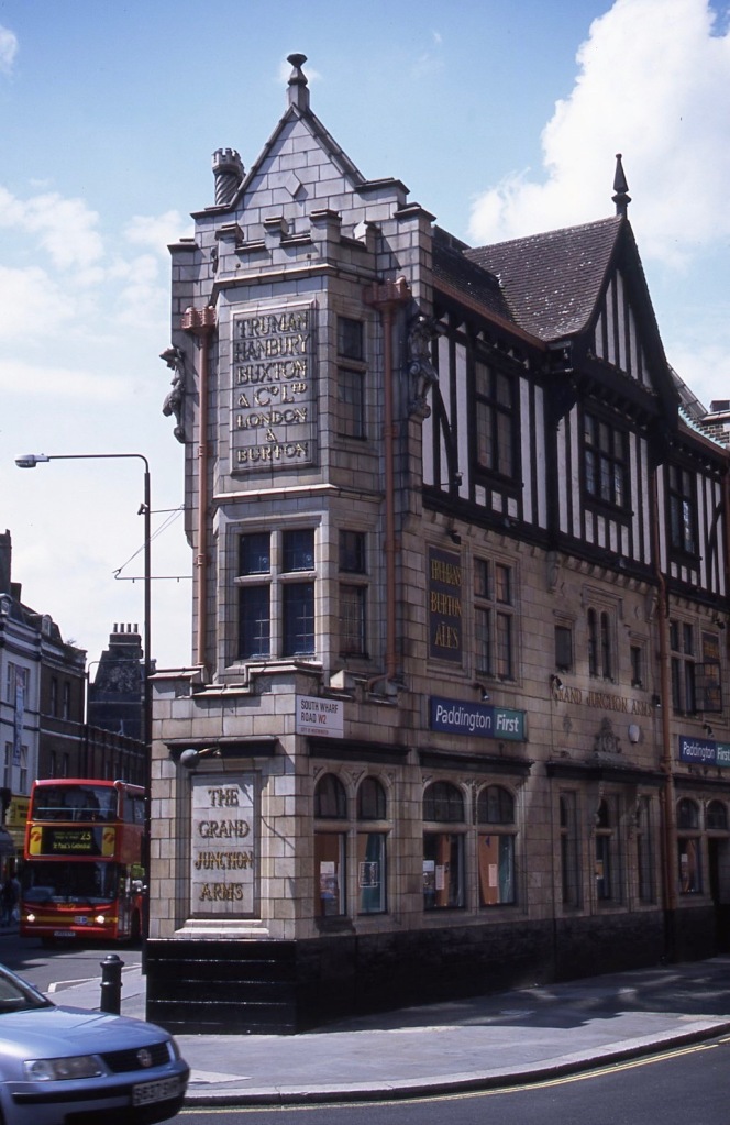
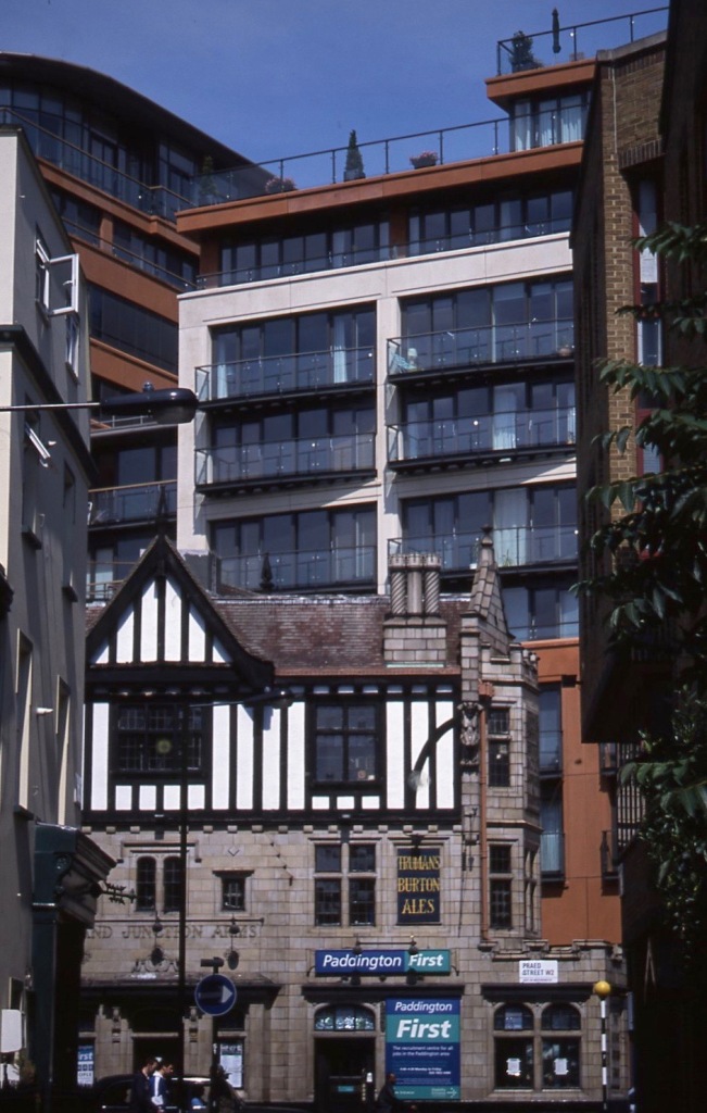
St Mary’s Hospital in Praed Street, W2 is where, a little over a year later, I would be given a replacement left hip.

Was this a group of student medics? If so, were any of them in attendance at my surgery?

Architectural reflections may be viewed in Bayswater’s Cleveland Terrace W2

The hollyhocks in this garden on the corner of Scarsdale Villas and Earls Court Road W8 suggest that this slide is an interloper and must have been taken a month or two later. I wasn’t cataloguing quite so carefully during this period of one of life’s hiccups. The road mending sign blends nicely with the vibrant blooms.

Nahals Newsagent stands near Westbourne Park Tube Station at 114 Talbot Road on the corner of Powis Mews W11;

Powis Square is not far away;

nor is Westbourne Park Road W11. I wonder whether this fascinating kneeler still stands on the first floor ledge we see.

Nu-Line Builders’ Merchants have produced very professional tromp l’oeil users of their products to mask their windows on the corner of Kensington Park Road W11.

Elgin Mews W11, in a right angled bend, links this road with Ladbroke Grove,

off which we find Bassett Road W10, where there seems to be pruning of plane trees under way;

Faraday Road W10 with its very modern Fire Station;

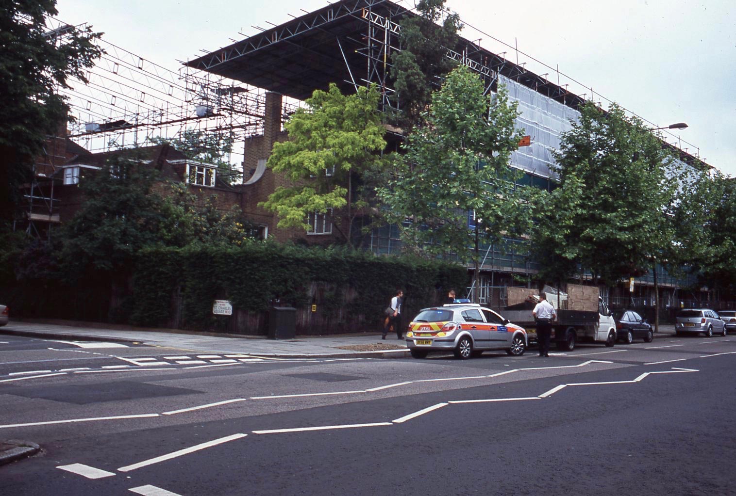
and St Charles Square W10, on the corner of which someone appears to be in trouble.

Sadly, Samuel Becket had recently been defaced in Blenheim Crescent W11 at its junction with Portobello Road. This 2006 work by Alex Martinez was based on a photograph produced by Jane Bown in 1976. It has now been painted over.

Jackie normally labels pre-cooked meals that she stores in the freezer. When she produced tonight’s protein item she had been distracted from doing so. The crunchy carrots and cauliflower; tender spring greens; rich red cabbage were served with fish, not cottage pie. The meal was, nevertheless, most enjoyable. The Culinary Queen had prepared her splendid beef gravy, but refused to give it to us. She drank Hoegaarden while Elizabeth and I drank Casillero del Diablo Reserva 2016.


Mostly North London

CLICK ON IMAGES TO ENLARGE.

Today I returned to the Streets of London series and scanned the next dozen slides from September 2004.

Sheldon Square W2 9.04

The Sheldon Square development in the old Paddington Basin of the Regents Canal was still being built in the years immediately after the millennium. It probably sports an official road name now.

Wikipedia has a lengthy feature on Marwan Barghouti. This is the introductory paragraph:

‘Marwan Hasib Ibrahim Barghouti (also transliterated al-Barghuthi; Arabic: مروان حسيب ابراهيم البرغوثي‎‎; born 6 June 1959) is a Palestinian political figure convicted and imprisoned for murder by an Israeli court.[1] He is regarded as a leader of the First and Second Intifadas. Barghouti at one time supported the peace process, but later became disillusioned, and after 2000 went on to become a leader of the Al-Aqsa Intifada in the West Bank.[1][2] Barghouti was a leader of Tanzim, a paramilitary offshoot of Fatah.[3]

Israeli authorities have called Barghouti a terrorist, accusing him of directing numerous attacks, including suicide bombings, against civilian and military targets alike.[4] Barghouti was arrested by Israel Defense Forces in 2002 in Ramallah.[1] He was tried and convicted on charges of murder, and sentenced to five life sentences. Marwan Barghouti refused to present a defense to the charges brought against him, maintaining throughout that the trial was illegal and illegitimate. The Inter-Parliamentary Unionreviewed the case and said that Barghouti had been denied a fair trial.

Barghouti still exerts great influence in Fatah from within prison.[5] With popularity reaching further than that, there has been some speculation whether he could be a unifying candidate in a bid to succeed Mahmud Abbas.[6]

In the negotiations over the exchange of Palestinian prisoners for the captured Israeli soldier Gilad Shalit, Hamas insisted on including Barghouti in the deal with Israel.[7][8] However, Israel was unwilling to concede to that demand and despite initial reports that he indeed was to be released in the 11 October 2011 deal between Israel and Hamas, it was soon denied by Israeli sources.[9][10]

In November 2014, Barghouti urged the Palestinian Authority to immediately end security cooperation with Israel and called for a Third Intifada against Israel.[11]

Newcastle Place W2 9.04 1
Newcastle Place W2 9.04 2

In September 2004 this tent in Newcastle Place W2 provided a base for his supporters.

Praed Street W2 9.04

This corner of Praed Street stands opposite a side entrance to Paddington Station.

Highbury Grove N1 9.04

Over at Highbury Grove N1 in Islington, we see the common juxtaposition of different eating places, so common in London.

Baalbec Road N5 9.04

Linda Tyrie grew up in Baalbec Road N5. This is the opening paragraph of her article in the Journal of the Islington Archaeology and History Society of Summer 2013:

‘I grew up from 1944 to 1962 in the ground floor of a house in Baalbec Road, backing on to Highbury Fields. The fields and the beautiful avenues of trees formed a backdrop to my life – walking up Baalbec Road to the food office in Highbury Crescent/ Ronalds Road when I was very young with my mother’s coupon book to collect orange juice, and later walking through the Fields to Drayton Park school in Arvon Road and along Church Path through the fields to Brownies, Guides, church and Sunday school.’ (http://www.clcomms.com/iahs/201113/IAHS-summer-2013-web.pdf)

Highbury Terrace Mews N5 9.04

Highbury Terrace Mews

Horsell Road N5

and Horsell Road N5, are both nearby.

Holloway Road N7 9.04

The latter being just off Holloway Road, another demonstrating the cosmopolitan nature of London’s cafés, and the proliferation of graffiti. This brief history is from the Hidden London website:

‘The Holloway district takes its name from the road, which was known as the ‘hollow way’ (the road in a hollow) by the early 14th century, when it had become the City’s main route to the north. The hamlet of Ring Cross had grown up around the junction with Hornsey Road by 1494.

By the 17th century Holloway Road was notorious for its highwaymen but it became safer as houses began to connect Ring Cross with Lower Holloway, at the north end of Caledonian Road.

The construction of Archway Road brought an end to the area’s rural character in the 1820s. Holloway Road tube station opened in 1906, where Ring Cross had been. This section of under­ground line was constructed in tandem with the overhead railway running from King’s Cross to Finsbury Park – hence the station’s location, some distance from the more focal Nag’s Head locality. A prototype spiral escalator was installed at the station but never entered service.

Supermarkets have changed the face of Holloway Road over the last few decades. Sainsbury’s demolished a ravishing Victorian block of shops on their arrival in 1970. A Waitrose super­market replaced Jones Brothers’ department store in 1993. This and the opening of a Safeway at Nag’s Head prompted Sainsbury to sell out to Kwiksave (who subsequently retreated in favour of an Argos superstore).

Generally, the road’s mix of retailers is typical of inner (as opposed to central) London high streets, with the colourful exception of a cluster of fetish fashion shops near the junction with Liverpool Road. Secondhand shops of all kinds are also in abundance.

The London Metropolitan University (formerly the University of North London) gained an iconic landmark in 2004 with the opening of its graduate school, the capital’s first building by the architect Daniel Libeskind; supple­menting Rick Mather’s curved white block of 2000 and a brutalist concrete tower from its earlier days as a polytechnic.’

Hides Street N7 9.04

Hides Street

Westbourne Road N7 9.04

and Westbourne Road N7 are both within a stone’s throw of Islington’s Paradise Park. The latter is perhaps an appropriate location for the St Giles Christian Mission.

Leverton Street NW5 9.04

The barriers surrounding many of the capital’s roadworks, like these in Leverton Street NW5 in Kentish Town, bear the name Murphy.

This evening we dined on Jackie’s super spicy lemon chicken and crunchy vegetable rice. Neither of us imbibed.

Farringdon And Paddington

CLICK ON IMAGES TO ENLARGE. THOSE IN GROUPS ACCESS GALLERIES THAT CAN BE VIEWED FULL SIZE.

This morning I scanned another dozen colour slides from the Streets of London series, produced in July 2004.

Clerkenwell Road EC1 7.04 1

Clerkenwell Road EC1 was featured on 15th January. These were probably pictured at the same time as the first ones. I swear I had no idea what was being advertised in the Jack posters. Intensive Internet research informs me that this was a magazine for gentlemen of a more intellectual bent than most. 2004 was its final year of publication.

Clerkenwell Road EC1 7.04 2

The church in the second shot is that of St. James. From about 1100 to 1539, when it fell foul of King Henry VIII’s dissolution of the monasteries, St. Mary’s nunnery stood on the site. Grafted onto the remains of the nunnery church in 1540, the place of worship, after several alterations, was rebuilt in the18th century, being dedicated in 1792. That is the building you see today. It is not, in fact, attempting to emulate the leaning tower of Pisa, but the width of this shot distorted the image so that I had to choose between the circular structure in the foreground and the more distant church to straighten.

Clerkenwell Road EC1 7.04 3

This view is a little further down the road. Here is a link to Susannah Hall’s website: https://susannahhall.com

Clerkenwell Close EC1 7.04

This young lady, pretty in pink, brightened up Clerkewell Close EC1

From its junction with Clerkenwell Road, Farringdon Road EC1 runs south to Blackfriars Bridge. It is Greville Street that climbs the hill up to Hatton Garden in the second picture.

Cowcross Street EC1 7.04

A public house has existed on the site of The Castle in Cowcross Street EC1 from at least the 18th Century. According to Wikipedia “it was once frequented by King George IV, who issued the landlord with a pawnbroker’s licence and handed over his gold watch to obtain some cash after losing money on a cockfight.”

Benjamin Street EC1 7.04

Both Cowcross Street and Benjamin Street EC1 lead to Farringdon Station. The BAR E S on the corner has lost a couple of letters. There is no truth in the rumour that Johnny Depp’s Sweeney Todd gave Alan Rickman a close shave in these premises.

[youtube https://www.youtube.com/watch?v=omD3m-xwBWk&w=560&h=315]

The 19th century Grand Junction Arms, as refurbished in the 1930s in Praed Street, dwarfed in 2004 by the development of Paddington Basin, at the end of South Wharf Road W2 was, I understand, closed possibly as recently as last year.

Junction Place/Praed Street W2 7.04

Junction Street W2 forms a corner with Praed St,

St Michael's Street W2 7.04

and St Michael’s Street runs parallel to it.

This evening we dined on aromatic lemon chicken; sautéed leeks, peppers, and mushrooms; boiled potatoes and carrots; and Jackie’s piquant cauliflower cheese. She drank Hoegaarden, and I drank Lion’s Lair Shiraz 2013.


Around West London

Feeling a little better today, I dozed away the morning, got up for lunch, and scanned another dozen slides from the Streets of London series. These were all made in April 2004.

Streets of London 4.04046

This young mother, speaking on her mobile phone in Avery Row W1, to the west of New Bond Street, blended perfectly with her surroundings.

Streets of London 4.04047

Further west, Westbourne Terrace Road Bridge crosses the Regent’s canal in Little Venice. As the plaque indicates, this was once in the Borough of Paddington which was absorbed by Westminster in 1965.

Streets of London 4.04051

The Bridge House pub lies at the corner of Westbourne Terrace Road and Delamere Terrace. The pub was fortunate enough to survive World War 2 bombing, which is more than can be said for many of its neighbours.

Streets of London 4.04048

The Little Venice area lies within the parish of St Mary’s on Paddington Green, visible in this view of St Mary’s Square.

Streets of London 4.04055

The A40 flyover overlooks a bricked up end of the square, and in 2004 the now- completed apartments for sale in Paddington Walk were still being built.

Streets of London 4.04052

Church Yard Walk provides a route through to Edgware Road.

Streets of London 4.04049

Sussex Gardens W2 forms a T junction with Praed Street, which is always as congested as this.

Streets of London 4.04050

Marylebone’s St Christopher’s Place looks like an alfresco dining room.

Streets of London 4.04053

Maintenance work was being undertaken at The Churchill Hotel in Portman Square.

Streets of London 4.04054

Ashland Place W1 is one of the many streets that enjoys a view of The Post Office Tower.

Streets of London 4.04056

Saint Michael’s Street W2 houses one of London’s many Starbucks coffee houses. I wondered whether the man on the chair was waiting for coffee, or simply having a breather. So many food and drink outlets place seats outside that are very tempting to people who simply want to sit down.

Streets of London 4.04057

The historic Mason’s Arms pub in Upper Berkeley Street was founded in 1778 and rebuilt in 1870.

This amble round West London was probably carried out on one particular day.

This evening we dined on Jackie’s famous sausage casserole; crisp carrots, broccoli, and green beans; and mashed potato, followed by treacle tart and custard.