Marylebone And Bloomsbury

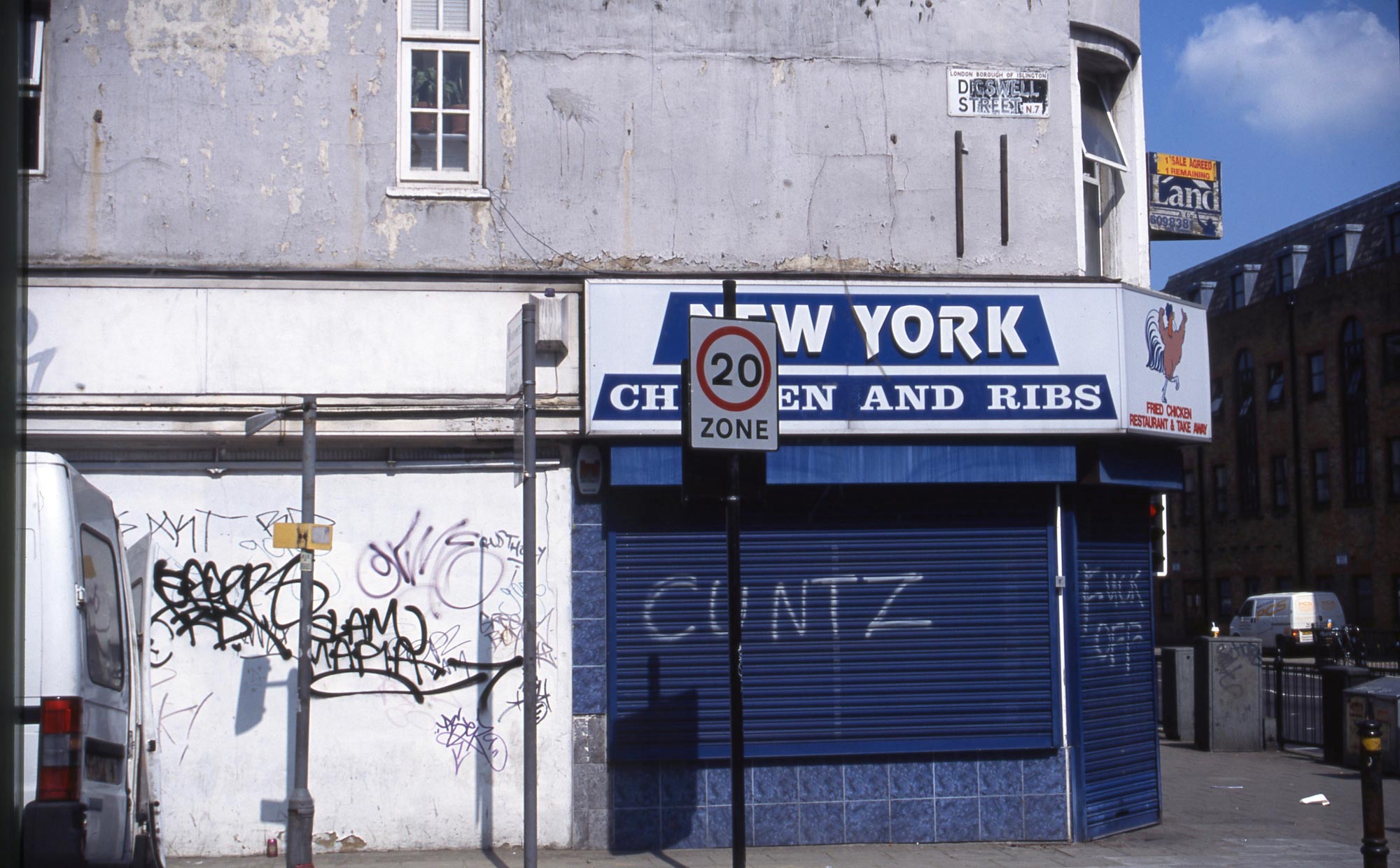
CLICK ON IMAGES TO ENLARGE. REPEAT IF REQUIRED. THE PAIRED ONES ACCESS THE GALLERY WHICH CAN BE VIEWED FULL SIZE.

Today being a rainy one, I scanned another dozen colour slides from my Streets of London series. These are from July 2004. I tramped these streets so often that I don’t know whether these were all produced in one day during the summer of my 62nd birthday, but it is quite possible. This lengthy post quotes extensively from the internet, so readers may choose either to read or to skip the further information included.

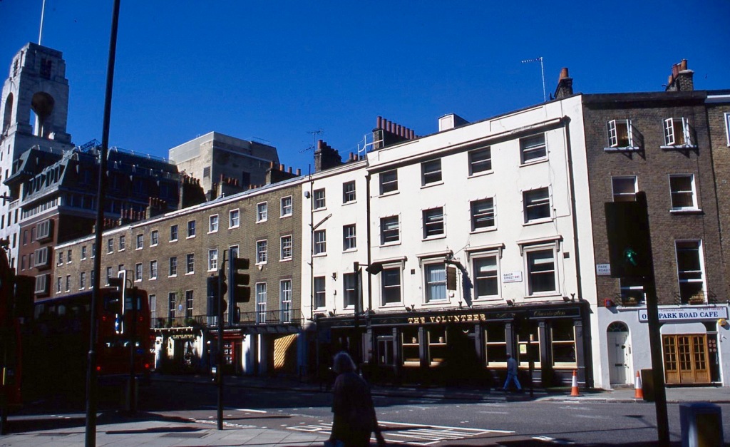
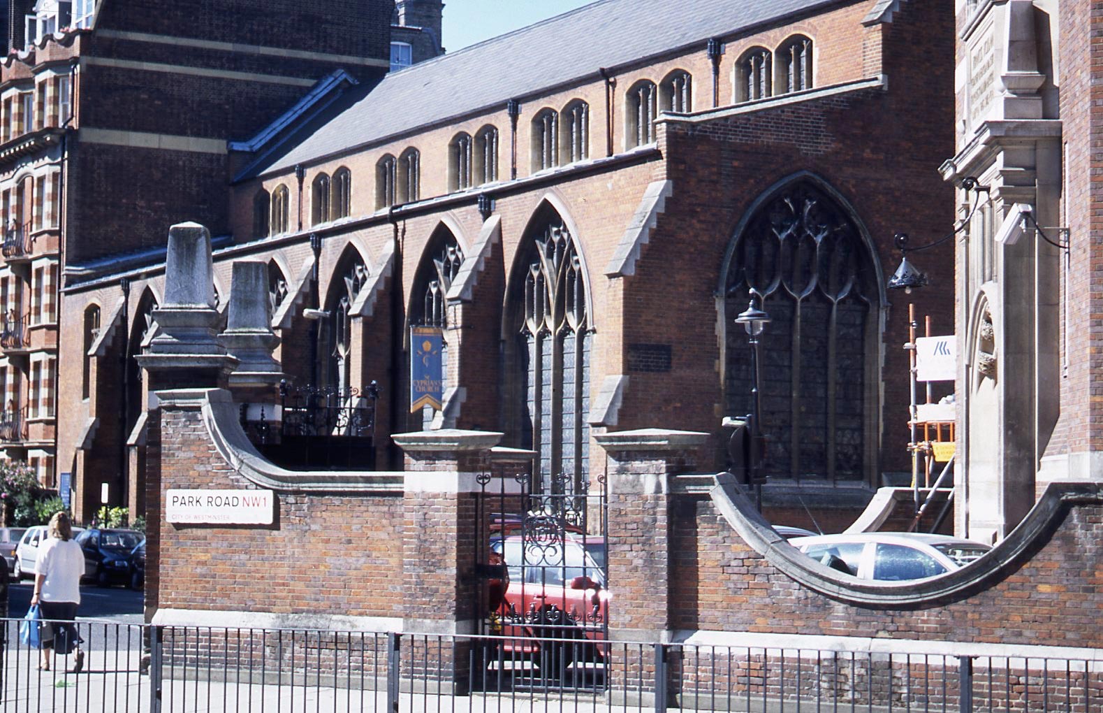
Park Road NW1 runs off Baker Street to Regents Park. Situated next door to the Sherlock Holmes Museum, The Volunteer public house is so named because it was a recruiting station during World War 1.

Allsop Place NW1

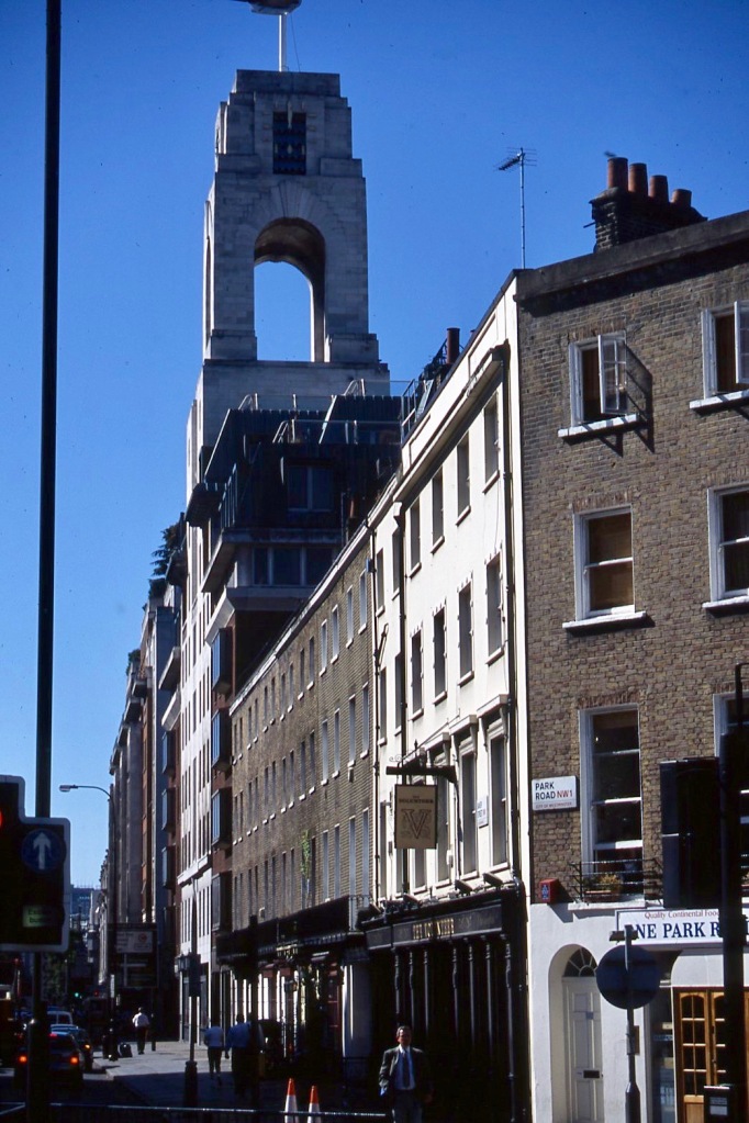
Allsop Place NW1, lies around the corner from the Marylebone Road entrance to Baker Street Station. Can you spot Sherlock Holmes?

Conway Street W1

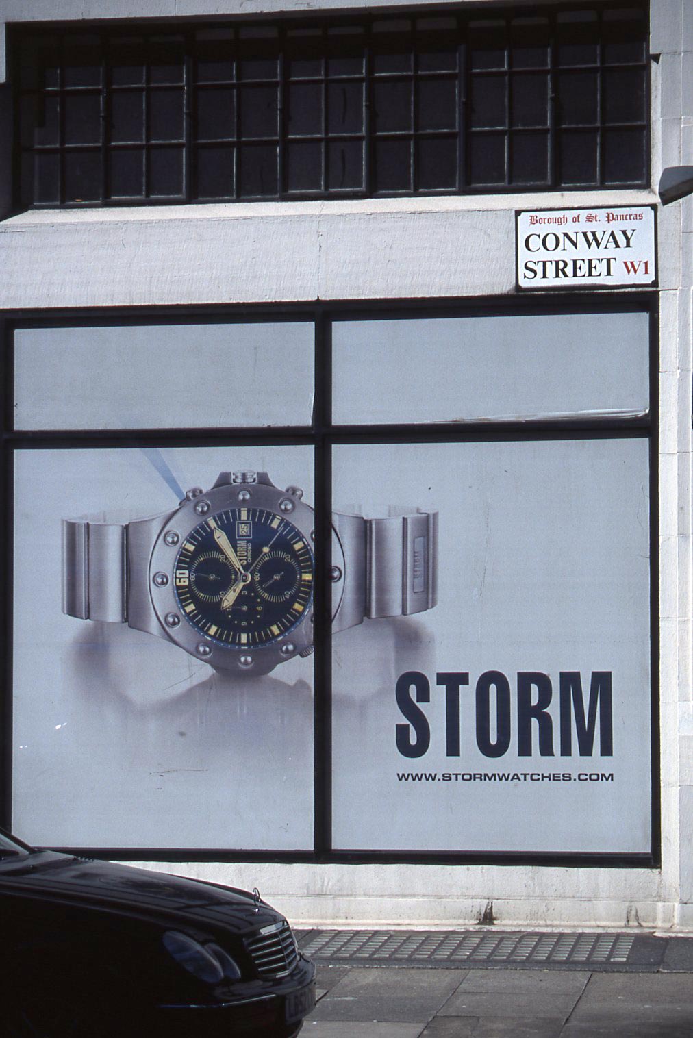
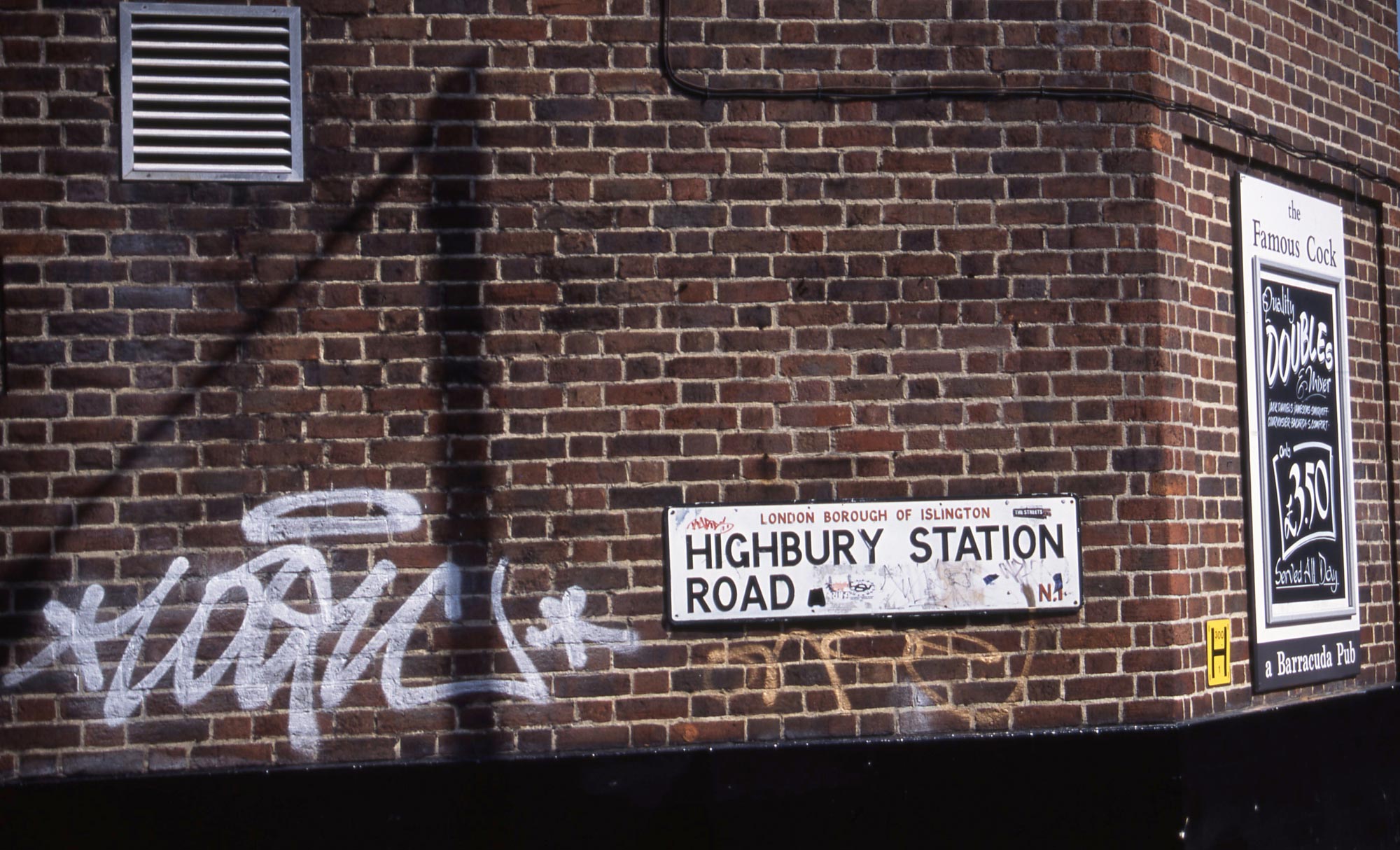
Dating from 1989 the Storm range of watches is rather younger than the Borough of St Pancras which was abolished in 1965 to become part of the London Borough of Camden.

Fitzroy Street W1

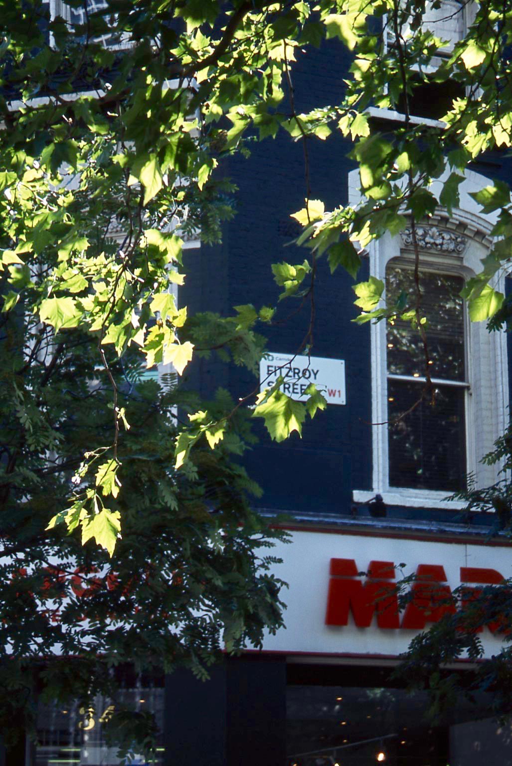
Fitzroy Street, W1, lies parallel to Tottenham Court Road, equidistant between Warren Street and Goodge Street underground stations. Many streets of the capital are lined with London Plane trees, the leaves of one of which almost obscures the sign.

Bidborough Street WC1

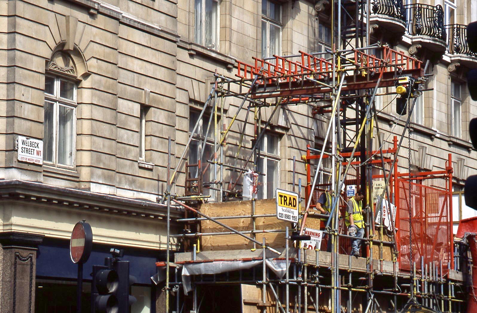
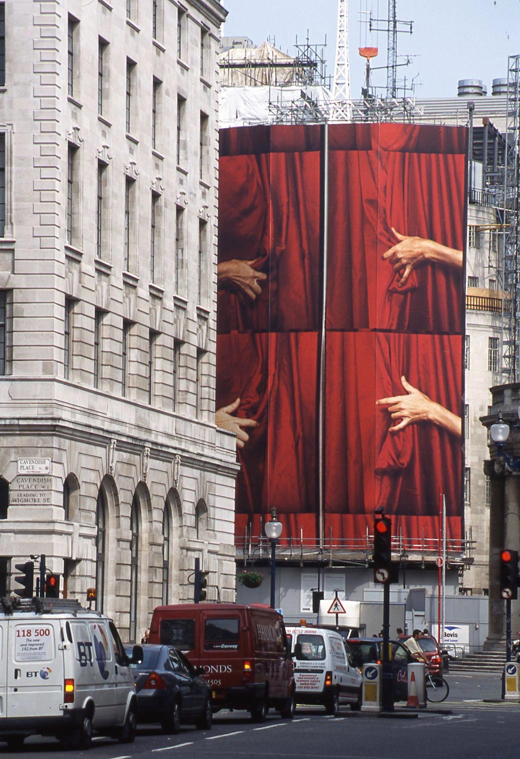
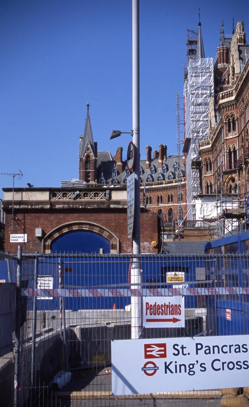
This shot is taken from the corner of Bidborough Street and Judd Street WC1 giving a view across Euston Road of the luxurious St Pancras Renaissance Hotel and the British Library. The scaffolding shows that the prolific Victorian Gothic revival architect Sir George Gilbert Scott’s magnificent hotel was, in 2004, undergoing extensive refurbishment. I suppose, at least in its materials and their colours, Sir Colin St John Wilson, intended the library to blend in with its more elaborate neighbour.

Coram Street WC1

Coram Street, WC1 is named after “Captain Thomas Coram (c. 1668 – 29 March 1751) [who] was a philanthropist who created the London Foundling Hospital in Lamb’s Conduit Fields, Bloomsbury to look after abandoned children. It is said to be the world’s first incorporated charity.” (Wikipedia) I first ventured into the Foundling Museum (https://en.wikipedia.org/wiki/Foundling_Museum) in Brunswick Square when, as an Assistant Child Care Officer in 1967, I attended a London Boroughs Training course there. I spent much of my time gazing at the art works on the walls. Little did I then know that in the 1990s I would chair a committee bringing together The Stepping Stone Community and The Thomas Coram Foundation.

Colonnade WC1

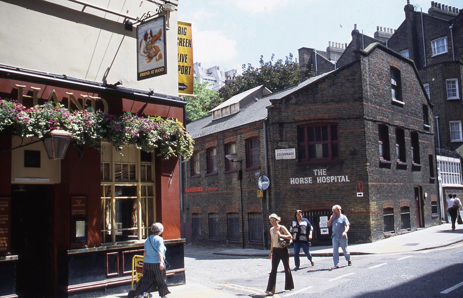
This is what Wikipedia tells us about The Horse Hospital:

“The Horse Hospital is a Grade II listed[1] not for profit, independent arts venue in central London, England, with a curatorial focus on counter-cultural histories, sub-cultures and outsider as well as emerging artists delivered through frequent events, underground film and artist’s moving image screenings, and exhibitions.[2] Founded in 1992 by Roger K. Burton,[3] the venue opened with Vive Le Punk! a retrospective of Vivienne Westwood‘s punk designs in 1993.

Initially programmed by Burton and Ian White, the venue’s reputation grew both in London and abroad. James B. L. Hollands later replaced White as curator. The artist, Tai Shani has been the programmer since 2006.

In 1998, the Horse Hospital hosted the debut British exhibition by outsider artist / painter Joe Coleman which attracted a new audience. Subsequently the venue played host to a variety of performers, musicians, artists, film makers and writers, including Dame DarcyAnita PallenbergIain AitchJack SargeantValie ExportChris CarterDavid TibetHelen ChadwickDennis CooperMorton BartlettLydia LunchBruce BickfordGee Vaucher and CrassAlejandro JodorowskyStewart HomeJeremy Reed and others.

It has also been used by various record labels, publishing houses including Soft Skull Press, Verso, Serpent’s Tail and Clear Cut Press. and journals such as Strange Attractor and Granta for special events, as well as a screening space for numerous film festivals including the Fashion in Film Festival, and London International Animation Festival amongst others.

Built originally by James Burton in 1797 as stabling for cab drivers’ sick horses, the Horse Hospital is notable for its unique stone tiled floor. Access to both floors is by concrete moulded ramps, the upper floor ramp retains hardwood slats preventing the horses from slipping. It can be found at Colonnade, Bloomsbury, London.

In 2015 The Horse Hospital was listed with London Borough of Camden as a Community Asset and the site was selected for inclusion in the British Library’s UK Web Archive as a website of cultural importance.

The Horse Hospital also houses and is supported by the ‘Contemporary Wardrobe Collection’, a fashion archive that specialises in post-war street fashion, sub-cultures and British design.”

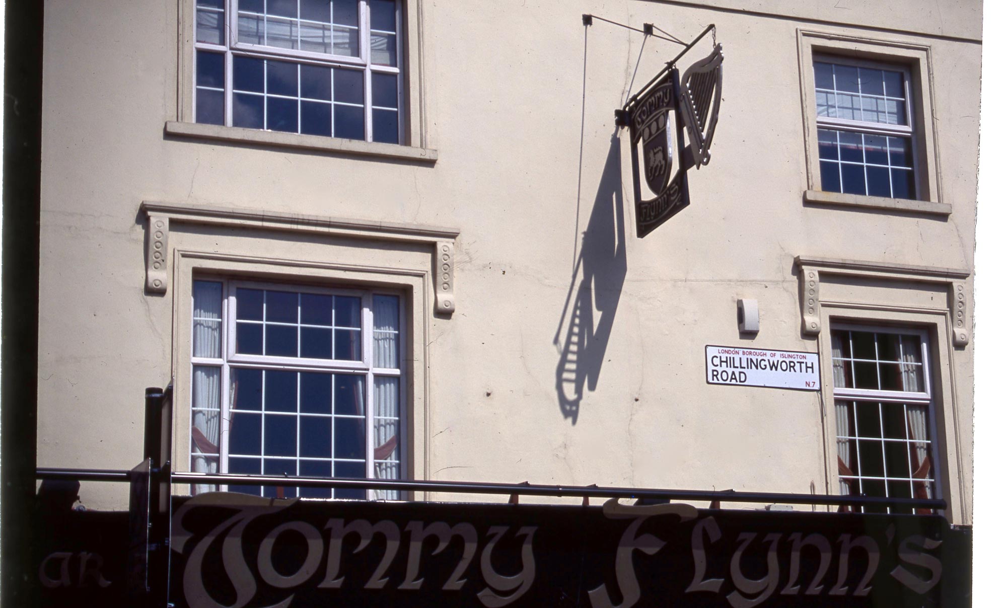
The Friend at Hand was built in 1735.

Herbrand Street WC1

Just around the corner lis the Celtic Hotel. Tom Meyers, EuroCheapo staff writer gives it top spot:

“The Celtic Hotel is one of our favorite budget hotels in all of Europe. It ticks off the boxes for all of the things we hold dear: lovely proprietors, reasonable rates, clean rooms, and a central location. In short, it’s hard to find anything to complain about (aside from the difficulty of booking a room, given the hotel’s popularity!).

Located just down the block from Russell Square, the Celtic is comprised of three townhouses combined into a hotel, and thus its 35 rooms vary quite significantly in size. However, high ceilings and pastel-toned walls help make even the tiny singles feel a little less cramped. Furnishings are basic and utilitarian, with simple curtains and comforters, but there are a few details (like framed floral prints and cute lamps) that increase the charm quotient.

Amenities are sparse, but all rooms offer free Wi-Fi and TV. The bathroom situation depends on which type of room you book: The most basic (and cheapest) singles and doubles share toilets and showers, although all are equipped with their own in-room sinks. The most expensive rooms have private bathrooms, while there are also middle-of-the-road rooms that have either only a shower or only a toilet.

Whatever the configuration, the bathrooms are spotless and there are plenty of shared facilities to go around. The especially modest should note, however, that the “shower-no-toilet” rooms have free-standing showers—with no separate door.

Additionally, the Celtic offers one small apartment in the basement that sleeps up to four. It’s a homey space with an old fireplace, one double bed, two twins and a small kitchenette.

The Hotel Celtic has two spacious lounges, each done up with a mishmash of comfortable furniture and traditional fireplace. One has a television, and both are great for curling up with a book or stroking the resident cat (named “Dog”).

Mr. and Mrs. Marazzi, the Celtic’s very friendly Italian owners, keep the place comfortable and homey. The family is so friendly that when they moved operations (from the St. Margaret’s Hotel, a former EuroCheapo favorite located just a few blocks away), virtually their entire staff wanted to move with them. (Read our Q&A with Mrs. Marazzi here.)

While the Celtic’s rates aren’t the absolute cheapest in London, given its top-notch service and its location bang in the center of town (across the street from Russell Square, and very near the British MuseumKings Cross Station and the West End), the hotel represents a great value.

Breakfast, included in the room rate, is made to order and served in a light, airy room with mirrored walls.

Note: The hotel does not have an elevator, but three bedrooms are located on the ground floor.”

Cosmo Place WC

The 18th century ‘Queen’s Larder’, in Cosmo Place WC, according to the publicans  “takes its name from Queen Charlotte, wife of the ‘Mad King’ George III, who was receiving treatment for his apparent insanity at a doctor’s house in the square.

The Queen assisted in the nursing of her husband, by cooking for him and rented a small cellar beneath the pub, where she kept special foods for him.” 

I have taken the liberty of removing one superfluous apostrophe and inserting another that was missing.

Old Gloucester Street WC

The Mary Ward Centre (https://en.wikipedia.org/wiki/Mary_Ward_Centre) is an adult education centre occupying converted 18th century houses at 42 Queen Square. One of the alternative entrances lies in Old Gloucester Street, WC.

Dean Street W1

Dean Street, W1 lies in the heart of Soho, a stone’s throw from our flat in Horse and Dolphin Yard in the 1970s. Examples of the modern version of the sandwich board have featured before.

This evening we dined at Lymington’s Lal Quilla. My choice of main meal was chicken jaljala; Jackie’s chicken shashlik; we shared Dal Shabji, plain Naan, and special fried rice; and both drank Kingfisher.


Marylebone And St John’s Wood

CLICK ON IMAGES TO ENLARGE. REPEAT IF NECESSARY

The car broke down as Jackie was leaving for a shop yesterday afternoon. We counted our blessings that this had not happened during our weekend trip to Nottingham. It did, however, mean that a domestic day was in order. Consequently I scanned another dozen colour slides from the Streets of London Series (May – June 2004). These were uploaded into WordPress without too much need for gnashing of teeth.

Manchester Street W1 5.04

Manchester Street W1, Lies between Baker Street and Marylebone High Street;

Hinde Street/Marylebone Lane W1 5.04

not far away is the Danish Express Laundry on the corner of Marylebone Lane at 16 Hinde Street, W1. This appears to be very popular.

Jason Court W1 5.04

Still in Marylebone, was this gentleman attending to the water supply?

Welbeck Street W1 5.04

There was the ubiquitous scaffolding in nearby Welbeck Street, W1;

Cavendish Place W1 5.04

and, in Portland Place, near Cavendish Place, W1, an example of the imaginative screening that is sometimes erected round more extensive building works.

John Prince's Street W1 5.04

Regular readers will realise that the music posters in Margaret Street are out of focus because I was fixed on featuring John Prince’s Street sign. Kevin Little is clearly visible, but I cannot read the legend of the young lady who also adorns the post. I think she is the UK R & B singer, Javine.

Margaret Street/Marylebone Passage W1 5.04

Wikipedia tells us:

“The London Fo Guang Shan Temple is located at 84 Margaret Street, London W1.[1] It was established in 1992 and is also known as International Buddhist Progress Society. It is one of two British branches of Fo Guang Shan Monastery, Taiwan.[2]

The temple is located in a former parish school and Church House of 1868-70 designed by William Butterfield. The building is grade II* listed.[3]”

On the wall of the earlier religious establishment can be seen the remnants of its contemporary street sign.

Bucknall Street WC2 6.04

Bucknall Street, WC2 lies just south of New Oxford Street. Scaffolding was also in place there. The wood block is probably in situ to prevent drivers mounting the kerb in this narrow little street.

Salisbury Street NW8 6.04

The Traders Inn at 52 Church Street on the corner of Salisbury Street, NW8, stands on a site from which gas masks were issued in 1939. Memories of that time are recorded in http://www.churchstreetmemories.org.uk/page/bert_black

Ashbridge Street NW8 6.04

Whoever parked his or her bike in Ashbridge Street, NW8, was taking a risk. Perhaps the reflected gentleman using the public phone box hadn’t yet caught up with the mobile revolution.

Gateforth Street NW8 6.04

The two figures in this photograph are indicative of the multi-cultural nature of our capital. Gateforth Street NW8 was named Capland Street until 1915. The Duke of York was rebuilt in its present form in 1932, and closed in 2007, three years after it entertained followers of Euro 2004. I believe it is now a restaurant.

Park Road NW1 6.04

St Cyprian’s Church commemorates the third century Christian martyr and Bishop of Carthage. The current building dates from 1903, and its history is told in: https://en.wikipedia.org/wiki/St_Cyprian’s,_Clarence_Gate

This evening we dined on Jackie’s perfect pork paprika, new potatoes, and crunchy carrots and cauliflower. Jackie drank Hoegaarden, and I drank more of the Côtes du Rhone. Observant readers will note that we have enjoyed this basically Hungarian dish three days in succession. That is because, fortunately, the Culinary Queen had made enough for six servings.


Marylebone And Little Venice

CLICK ON IMAGES TO ENLARGE. REPEAT IF REQUIRED

..Today I scanned another batch of my Streets of London colour slide collection, this time from June 2004.

Warwick Crescent W2 6.04

Warwick Crescent, W2 lies in the heart of Little Venice, as evidenced by the Regents Canal basin in the foreground. Much of this street was bombed during WW2. The building to which the street name is fixed is a survivor. One other, to the far left, out of the picture, is the 19th century Beauchamp Lodge, where I rented my counselling room. The rest consists of 1960s council building. We were bemused when, in the 1980s these boringly banal boxes began to be tarted up. The answers were probably revealed when the Council Leader’s gerrymandering exercise was exposed. The Waterside Café provided good snacks, cakes, and beverages; the Waterbus offered trips along the canal to Camden Lock and back. During my running years I sometimes exchanged waves with passengers as I jogged alongside them.

Porteus Road W2 6.04

These steps taking pedestrians up from Porteus Street, lead to a bus stop at the large Harrow Road roundabout. To the left of the wall is the entrance to an underpass beneath the main thoroughfare. I knew people who would not use it for a not unreasonable fear of mugging. The trees at the top of the shot screen the canal.

Cabbell Street NW1 6.04 1Cabbell Street NW1 6.04 2

Here is another shot of our friend the bemused window cleaner of Cabbell Street, NW1, which contained some rather beautiful mansion flats;

Old Marylebone Road NW1 6.04

as does Old Marylebone Road;

Homer Row W1 6.04

a turning off which is Homer Row, W1. Traditional London taxi cabs are black. This driver chose red, and likes pink. The mansions shown above are reflected in his passenger window.

Crawford Street W2 6.04

Regular readers will know that my self-imposed constraint on this series is that a street name sign must be included. I cheated a bit in this one, because it is Crawford Place, W2 that is featured, but St Mary’s Church, Marylebone, is actually in Wyndham Place, NW1. I was intrigued by the various examples of geometry on display in this scene.

Bryanston Mews East W1 6.04

Since this area is one of Westminster’s most prestigious, road sweeper, like this gentleman in Bryanston Mews East, W1, are rather more in evidence than in the poorer London Boroughs.

Clay Street W1 6.04

The embassy of the Republic of Angola is situated in Dorset Street W1 alongside the corner of Clay Street;

Kenrick Place/Dorset Street 6.04

whilst on the corner of Dorset Street and Kenrick Place stands The Barley Mow, claiming to be the oldest pub in Marylebone. Time Out had this to say on 17th May 2013:  “This corner pub in Marylebone started life in 1791 as a meeting place for farmers to pawn their goods. Legend has it that the wooden snugs (now listed) either side of the bar gave them a bit of privacy in which to make their transactions. These days, there’s a good range of lagers and bottled beers along with the ales, plus food (mainly Pieminster pies), with music in the evening mix.”

Broadstone Place W1 6.04

I wasn’t the only one with a camera on the go in Broadstone Place, W1.

Blandford Street/Manchester Street W1 6.04

The Tudor Rose pub on the corner of Blandford and Manchester Streets, W1 is featured in the London Pub Review website, thus: “Our dire predictions haven’t come true – this one’s still not changed in years. Good. It’s not a bad place at all, with decent beer on the hand pumps and proper pub grub served downstairs (upstairs there’s a restaurant) including such delights as Spam fritters. Being in a Marylebone backwater, this place hardly ever gets crowded, although there’s a weekday lunchtime trade, so if you need place for a quiet pint in the area, this place will do nicely. The service is prompt and friendly and the prices are on par for the area. Whilst you wouldn’t necessarily make a special effort to seek this place out, if you’re in the locale, do drop in. Oh, except on a Sunday – it’s closed.”

making-cauliflower-bahjicauliflower-bahji-half-way

While I was working on this post, aromas of cumin and coriander led me to investigate the kitchen, where Jackie was occupied inventing her own cauliflower bahji,

Lamb jalfrezi, Cauliflower bahji, basmati rice

which we were to enjoy for dinner with her classic lamb jalfrezi and basmati rice with onions and peppers.

Paddington, Marylebone, And Islington

CLICK ON IMAGES TO ENLARGE. REPEAT IF NECESSARY.

Today I scanned another dozen colour slides from the May 2004 selection of Streets of London.

Cabbell Street N.W.1 5.04

Someone with an excellent sense of humour commissioned this window cleaner scratching his head as he contemplates tackling the M & S glass fronted tower building opposite Edgware Road tube station in Cabbell Street, NW1. Note the graffiti on the phone box.

Paddington Green W2 5.o4

Paddington Green,

Sarah Siddons

home of Sara Siddons (photographed on July 16th 2013) whose nose job has been unsuccessful;

North Wharf Road W2 5.04

North Wharf Road, where the windows of this building reflect construction going on around it;

Harrow Road W2 5.04

and Harrow Road, all W2, are all within the vicinity of Paddington. Once again we were coming into summertime, when the residents of these small flats could hang their washing out on tiny balconies otherwise used for flower pots and hanging baskets.

Tresham Crescent NW8 5.04

At this time I regularly walked from Little Venice in W9 to Parents for Children in Islington’s N1. Depending on my chosen route, I passed through Tresham Crescent, NW8, where the City of Westminster managed a children’s home,

Paveley Street NW8 5.04

and Pavely Street, near Regent’s Canal, wondering whether the Blue Square air balloon was heading for Lord’s Cricket Ground.

Barrow Hill Road NW8 5.04

Passing the cricket ground, I would have traversed Barrow Hill Road,

Barker Drive NW1 5. 04

and travelled on along Barker Drive, NW1, where was draped another reminder that this was Arsenal Football Club’s annus mirabilis.

Agar Grove NW1 5.04

Agar Grove was quite a long stretch, probably more so for the broken down vehicle.

Laycock Street N1 5.04

By Laycock Street, I would have neared my goal. Reflected in the window of the modern building is the older street name.

Marylebone High Street NW1 5.04

Back in Marylebone, I walked many a time along the length of both Marylebone Road,

Marylebone Road/Marylebone High Street NW1 5.04

and Marylebone High Street, NW1. The splendid domed building shown in these last two shots is St. Marylebone Parish Church, described by Wikipedia as an Anglican church on the Marylebone Road in London. It was built to the designs of Thomas Hardwick in 1813–17. The present site is the third used by the parish for its church. The first was further south, near Oxford Street. The church there was demolished in 1400 and a new one erected further north. This was completely rebuilt in 1740–42, and converted into a chapel-of-ease when Hardwick’s church was constructed. The Marylebone area takes its name from the church. Located behind the church is St Marylebone School, a Church of England school for girls.’

This evening Jackie produced a superb roast lamb dinner. The only item that was not exquisitely crunchy was the tender lamb itself. It was served with roast potatoes, parsnips, carrots, and broccoli, all cooked and timed to perfection. Tasty gravy was added. The Culinary Queen drank sparkling water and I drank Patrick Chodot Fleurie 2014.

May Fair

CLICK ON IMAGES TO ENLARGE. REPEAT IF REQUIRED.

Incessant rain had hammered down for 24 hours after the family left yesterday. It was not until mid afternoon that we could go outside to survey the damage and stake up the taller plants like

Nico

these nicotiana sylvestris that had been beaten and weighed down.

Gladioli Priscilla

Some, such as the Priscilla gladioli, had been broken off completely. Becky made their  vase  more than 20 years ago.

In the meantime, I scanned another dozen slides from May 2004 in my Streets of London Series.

Streets of London 430

During that time I regularly walked past Murray Road NW1 on my way to visit a foster home in North London. The maroon concrete planters were part of the London Borough of Camden’s efforts to brighten up the streets.

Streets of London 431

Essie Carpets, at 64 Piccadilly, on the corner of Albemarle Street, W1, sells Persian and Oriental rugs of allegedly superior quality. Never having been able to contemplate such luxuries I am unable to confirm this from my own experience.

Streets of London 432

Crossing Piccadilly and walking through Piccadilly Arcade, one comes face face with Beau Brummell, that famous Regency dandy about whom Wikipedia has this entry: https://en.wikipedia.org/wiki/Beau_Brummell

The sculpture was made by Irene Sedlecka in 2002.

Streets of London 433

Streets of London 434Streets of London 435

The next three photographs were made in a district which came to National consciousness in the 1980s when ‘the deputy Conservative Party chairman and author Jeffrey Archer met the prostitute Monica Coghlan‘ This last phrase and the next three paragraphs are slightly edited extracts from Wikipedia.

‘Shepherd Market is a small square in the Mayfair area of central London, developed in 1735-46 by Edward Shepherd on the open ground then used for the annual May fair from which Mayfair gets its name. It is located between Piccadilly and Curzon Street and has a village-like atmosphere. The area was called Brook Field, through which flowed the Tyburn. It contained paved alleys, a duck pond, and a two-storey market topped by a theatre.[3]

During the 1920s, Shepherd Market was a run down area, popular with writers and artists such as Michael Arlen and Sophie Fedorovitch.[4] Arlen rented rooms opposite The Grapes public house and used Shepherd Market as the setting for his best-selling 1924 novel The Green Hat, which prompted Anthony Powell to move into the area in 1926.[5]

It has been associated with upmarket prostitutes since the eighteenth century.[2] When Olivia Manning and her husband Reggie Smith lived at 50a, she found the prostitutes “fascinating”.[6]

Jeffrey Archer once cajoled thousands of pounds from guests at a Charity Dinner auction on behalf of Parents for Children Adoption Society during my period of Chairmanship.

Streets of London 436

I assume the driver of this police car alongside Chesterfield Street, still in Mayfair, was seeking directions from a colleague.

Streets of London 437

Hay’s Mews still contains some of the original converted stable buildings.

Streets of London 438

Around one corner is Waverton Street;

Streets of London 439

 Balfour Mews

Streets of London 440

and Rex Place run into S. Audley Street where services are still held in the 18th century Anglican Grosvenor Chapel.

Streets of London 441

This young man must have taken his life in his hands as he crossed Park Lane and straddled the stride-stretching barrier to reach this strip of grass. And he could manage to sit cross-legged afterwards.

This evening Jackie collected our dinner from the garrulous Mr Chatty Man Chan at Hordle Chinese Take Away. Dessert was treacle tart and ice cream. We both drank Kingfisher

Multi-Ethnicity

CLICK ON IMAGES TO ENLARGE. REPEAT IF REQUIRED

Jackie spent much of the day cooking for tomorrow’s guests. I finished the hoovering and did a bit of tidying up. I then paid attention to the rest of the May 2004 colour slides from the Streets of London series, scanned yesterday.

Continuing yesterday’s walk along Kilburn High Road, a bit further North of The Old Bell is the short

Birchington Road NW6 5.04

Birchington Road NW6, which has a bank on one corner

Birchington Road NW6 5.04 2

and fairly large residential houses bearing the tell-tale sign of multi-occupancy on the entry-buzzers. I am not sure which national dress is being sported by the elegant woman in the first picture.

Quex Road NW6 5.04

Next on the right is Quex Road, where preparation in the greetings card shop was under way for Father’s Day in June.

The Terrace NW6 5.04

A short distance further, and The Terrace is on the left. This Felfala Restaurant is apparently no longer in operation, although there are a number of others listed nationwide. I’m surprised I didn’t go back and try it when I had the chance.

Kingsgate Place NW6 5.04

Almost opposite on the right is Kingsgate Place. No self-respecting high street in the less salubrious areas of our cities is without its ‘Pound Shop’ or equivalent.

Kingsgate Road NW6 5.04

The short Kingsgate Place runs into the more major Kingsgate Road. There is something rather poignant about RAKS NEWS AND RELIGIOUS GOODS bearing a placard from the Kilburn Times proclaiming ‘I was seduced by jailed pastor’. The Aerlingus advertisement is an indication that many Irish people live in Kilburn; encouragements to play the lottery and invest in Vernon’s Pools suggest a certain amount of need for some easy money; and the area is one ripe for graffiti.

Kilburn has quite a history, based on Kilburn Priory, “a small monastic community[1] of nuns established around 1130–1134 three miles north-west of the medieval City of London, where Watling Street (now Kilburn High Road) met the stream now known as the Westbourne, but variously known as CuneburnaKeneburnaKeeleburneColdburne, or Caleburn, meaning either the royal or cow’s stream.[2] The priory gave its name to the area now known as Kilburn, and the local streets Priory Road, Kilburn Priory and Abbey Road.” (Wikipedia)

Abbot's Place NW6 5.04 1Abbot's Place NW6 5.04 2

Presumably Abbot’s Place has the same origin.

“The site was used until 1130 as a hermitage by Godwyn, a recluse, who subsequently gave the property to the conventual church of St. Peter, Westminster. The priory was established with the consent of Gilbert Universalis, bishop of London, before his death in August 1134. Though it was originally subordinate to Westminster Abbey, whose monks followed the Benedictine rule, by 1377 it was described as being an order of Augustinian canonesses. It was once believed that the Ancrene Riwle was written for the first three nuns of Kilburn, but this is now thought unlikely.

Agnes Strickland states that the priory was established in 1128 for the three pious and charitable ladies-in-waiting of Queen Matilda of Scotland, consort of Henry I, named Emma, Gunilda, and Cristina.

After the death of the queen [in 1118] these ladies retired to the hermitage of Kilburn near London, where there was a holy well, or medicinal spring. This was changed to a priory in 1128, as the deed says, for the reception of these . . . damsels who had belonged to the chamber of Matilda.[5]

Kilburn Priory was dissolved by Henry VIII in 1537 and its site in Kilburn was given to the Knights of St. John in exchange for other property, and then seized back by the crown in 1540.” (Wikipedia)

Kilburn Priory NW6 5.04

There is something sweet about Islamic Centre England being housed in Kilburn Priory, (Actually 140 Maida Vale) in the midst of such a multi-ethnic area.

Andover Place NW6 5.04

Parallel with Maida Vale, on my return to Warwick Crescent, I walked along Andover Place.  These two young women were happy to appear in my project. I swear I didn’t arrange the pose.

Elgin Mews North W9 5.04

Back in W9, work was being completed on a development in Elgin Mews North.

This evening we dined on Jackie’s excellent heart casserole, carrots, runner beans, and new potatoes. This was followed by strawberries and cream. Well, we had been watching the Wimbledon tennis on T.V.

The Old Bell

This morning I mended a garden chair and did the hoovering, while Jackie continued her mammoth garden maintenance. This afternoon I watched Wimbledon tennis on TV, while Jackie continued her mammoth garden maintenance. Between matches, I scanned another batch of colour slides from the Streets of London series from May 2004.

Springfield Lane NW6 5.04

This corner of Springfield Lane and Kilburn High Road NW6 is the only one of these I will feature today.

That particular walk is the only time I have ever investigated Kilburn High Road and its environs. I could not therefore remember the building that the tiles fronted, although I felt sure it would be a pub. The London stock bricks used for the building’s construction are very popular, expensive, and sought after by architectural salvage merchants and thieves. They have been in use since Georgian times.

North London was developed much earlier than the originally swampy south, which was only really extended with the coming of the Underground. That is why you are more likely to see evidence of street name changes in the North. Clearly this Lane was once Goldsmith’s Place.

I therefore went on an internet search prompted by this one corner of N.W.6.

Ed Fordham’s blog post of 24th June 2008: http://474towin.blogspot.co.uk/2008/06/old-bell-public-house-in-kilburn.html provided me with the following clarification:

“The Old Bell Pub is one of the oldest pubs in Kilburn and probably even dates from the time of Kilburn Priory. At the bottom of the Kilburn High Road it’s at the strategic junction of the old Roman Road Watling Street, the old Kilburn River and the now railway line and associated bridge.

In more recent times it was the principle pub in the 30’s (sic) at which many Irish workers could find accommodation – there used to be blackboards with chalk listings of landlords and bedsits.

It’s credited with being on the spot behind which was the preaching field from medieval times through to the 1800’s (sic) (this is part confirmed by Goldsmith’s Place being renamed Springfield Lane…) and became the main drinking hole for those using the railway line after its’ (sic) arrival.”

The Old Bell, KilburnThis current image from Google shows the front of the building and, on the right, the corner I photographed. I’m not sure if the modern building was there then.

This evening Jackie produced her scrumptious savoury rice with chicken in sweet chilli sauce. She drank Hoegaarden, and I drank Fortezza Dei Colli Chianti Classico 2012.

I’ll feature the rest of the street scenes in a day or two.

Lee Van Cleef

CLICK ON IMAGES TO ENLARGE. REPEAT IF REQUIRED.

Not only was today wet, but we experienced 40 m.p.h. winds, and it was cold.

Beetles and raindrops on poppy

The flowers were taking another battering. It was a day for beetles, not for bees.

Thinking that few people would visit the recycling centre today, we transported two bags of green waste there. We were so wrong. The queue was 45 minutes long. Still, we got rid of our clippings and came back with one terra cotta and two stone planters.

Here, therefore, is what Paul Clarke terms a rainy day post. I scanned the next batch of my Streets of London series of colour slides from May 2004.

Crane Grove N.7. 5.04

I couldn’t make my mind up about whether this elegant house in Crane Grove N7 is Georgian or Victorian. Neither, it seems, can the Estate Agent who has it on the RightMove website priced at £1,500,000, and described as period. The period of the inside looks to me like last week.

Highbury Corner N1 5.04

Higbury Corner zoom

We are told that Highbury Corner is within walking distance of this home. I zoomed in on the block of flats that had attracted my attention because Arsenal’s championship Year was being celebrated on the top floor.

Digswell Sterrt, N7 5.04

Even nearer is Digswell Street with its gross graffiti. This lies off the Highbury end of Holloway Road, part of the A1 running North from Highbury Corner. It may, of course, have been cleaned up by now.

Upper Street N1 5.04

Upper Street is a continuation of this major thoroughfare running South.

Clifton Gardens W9 5.04

From Islington we move back to West London in the form of Clifton Gardens W9, in Little Venice, which, I think, was being graced with new street lighting. That is a pretty mature plane tree in the front garden of the building behind the wall.

Clifton Road W9 5.04 1

Clifton's Restaurant 5.04 Clifton Gardens becomes the short stretch of Clifton Road before Maida Vale is reached.

Clifton's Restaurant 5.04 2

In a basement at that corner Clifton’s restaurant struggled to survive in the 1990s, eventually making way for an Indian restaurant which didn’t last very long. Well, it wouldn’t, being diagonally across the road from the Akash.

I was an occasional visitor to this rather good subterranean eating place with normally excellent wines. John, the proprietor, was keen on the Daily Telegraph cryptic crossword. On learning of my sideline in such puzzles, he would sometimes seek my assistance.

This was in the time when people still smoked in restaurants. I smoked a pipe, but never in a restaurant. John had a ceiling extractor fan which he insisted had been installed for me to smoke my pipe. I did, occasionally when, as often, there were no other customers. The proprietor was prone to relate that Ringo Starr brought his family there on Sundays.

Observant readers will have noticed, the ‘normally’ in the description of the wines. The reason for this is that this is so far the only place where I had had to return a corked bottle. Poor John had to agree, and was rather upset at having served it.

On one memorable occasion a young gentleman behind me was introducing his lady companion to the joys of the spaghetti Westerns of Sergio Leone. This was the trio of low budget films bringing Clint Eastwood to fame as ‘The Man with no Name’. It just happened that I was a fan, and have been known to join in other people’s conversations. I couldn’t resist it. I just had to turn, politely ask if I could add my two pennyworth, and upon being welcomed, observe: ‘Forget Clint Eastwood. Lee Van Cleef is the man’. This made my interlocutor’s day. He agreed entirely. I hopefully thought that with any luck the young woman was amused. I was being rather tongue in cheek of course, but Van Cleef had the looks for the part.

Hall Road NW8 5.04

On the opposite corner of Maida Vale, with Hall Road, stands one of the luxurious apartment blocks that line this part of the A5.

Vale Close W9 5.04

Vale Close, just North of this point, is a small private road. Who would place this within a mile of Marble Arch?

For dinner this evening, Jackie produced a wholesome heart casserole, with crunchy carrots, new potatoes and green beans, followed by scones. These latter were eaten like those in traditional West Country cream teas, that is, with clotted cream and strawberry jam. This gave us a problem. These cream teas are native to both Dorset and Devon. The trouble is in one county you put the cream on first, and in the other, the jam. We couldn’t remember which was which, but we did think we might Google it and follow the practice of the county which had supplied our West Country Clotted Cream.

The address of the distributor was in East Kilbride in Scotland.

I put my cream on first. I don’t know which way the Culinary Queen voted.

Jackie drank Hoegaarden and I finished the Carles.

Graffiti Dominates

CLICK ON IMAGES TO ENLARGE THEM. REPEAT IF REQUIRED

Rose garden

This morning I dead-headed 24 prolific rose bushes. That was quite a lot of faded blooms. All my life I have understood the preferred method to be to snip off the used stem above the next join. Now, The Head Gardener informs me that current thinking is to break off the spent flower at its base, and leave it at that. Despite the convenient length of my thumbnails, I have had difficulty in doing this without peeling off a bit of the remaining stem. I have therefore cheated somewhat with secateurs.

rose Zéphirine Drouhin

The thornless Zéphirine Drouhin is now rising up the Rose Garden arbour

roses Zéphirine Drouin

opposite Crown Princess Margareta. Being seated between these two most fragrant ladies is a pleasure, indeed.

Clematis and pink climber

I did not neglect the front garden, where a clematis is now joining the pink climbing roses.

After this I dealt with some financial correspondence and posted my replies.

Then came a scanning session of a dozen more of my Streets of London colour slides from May 2004.

High Street Harlesden 5.04

The grey haired man in Harlesden High Street has to negotiate his way between the ladder  outside the boutique and the young man’s backpack. You don’t leave anything unattended in such an area without chaining it down. It was fairly optimistic hoping that the traffic cone would keep a parking space open. Note the graffiti and the To Let board, of which there is always a wide selection.

Honeywood Road 5.04

Honeywood Road’s Dunning’s Bar is not the only Irish establishment we will encounter on this ramble. Maybe some of my readers will be able to translate the Guinness advertisement. If there was once a lovely wood on this site, it is long gone. ‘Toilets are for patrons only’ is a common plea of landlords.

Tubbs Road 5.04

Tubbs Road has its share of graffiti and dumped rubbish. Even before we learned that there were no weapons of mass destruction ready to be unleashed on the Western world within 45 minutes, there were many disinclined to believe Mr Blair; and I suppose Che Guavara’s image will never leave our streets.

Station Approach NW10 5.04

Just around the corner is Willesden Junction Station, Station Approach road. There is something incongruous about an advertisement for The Economist perched upon a wall covered in graffiti. The name of the company, JCDecaux, who installed it has remained intact. Perhaps the can-wielding scribblers thought that was also a graffito.

Pancras Road NW1 5.04

At that time Pancras Road was very difficult for anyone, let alone a pedestrian, to negotiate. The splendid refurbishment of St Pancras Station and the King’s Cross redevelopment was well under way.

Highbury Station Road N1 5.04

A little further into N1 we come to Highbury Station Road, its wall being decorated with the now familiar sprayed scrawl. The Barracuda Pub’s Cock may have been Famous, but Google tells us that the chain is no more.

Highbury Place N1 5.04

I often wonder how graffiti merchants manage to place their messages high up on buildings, but here, in Highbury Place, a convenient fire escape provides a route. Torn posters are all the rage. Chaining bicycles to railings really is asking for trouble.

Fieldway Crescent N5

I do hope this was refuse collection day in Islington’s Fieldway Crescent.

Georges/Holloway Roads N7

Columbian and Chinese establishments in Holloway Road indicate the multicultural nature of this area of North London. Remington on the corner of George’s Road bears the yellow graffiti.

Chillingworth Road N7 5.04

Tommy Flynn’s in Chillingworth Road is another Irish pub.

Madras Place N7 5.04

I do believe Arsenal must have won the football championship in 2004. Madras Place, of course, is one both the many London streets named from our colonial past.

Drayton Park N5 5.04 (Should be 404 in series

These establishments on Drayton Park have not escaped the spray can. There is always a crane in operation somewhere in our capital.

This evening I dined on Jackie’s amazing chicken jalfrezi and egg fried rice, and drank Doom Bar.

Around My Patch

CLICK ON IMAGES TO ENHANCE THEM. REPEAT IF REQUIRED

Today I scanned another dozen colour slides from the Streets of London set. These were made in May 2004, by which time I was working as a therapeutic counsellor in Beauchamp Lodge Settlement in Little Venice’s Warwick Crescent.

Delamere Street W2 5.04

A turning off this small crescent was Blomfield Villas, the address of this building bearing the Delamere Street W2. Once quite grand, this row of houses was split into flats, some at least of which were owned by Westminster City Council. These ladies asked to be included in the shot.

Kilburn Park Road NW6 5.04

From 1974 to 1986 I was responsible for Westminster’s Area One Social Services Department. Here we have the end of Kilburn Park Road NW6 that forms a T junction with Shirland Road, running along the Northern side of my patch.

Third Avenue W10 5.04

Fourth Avenue W10 5.04Fifth Avenue W10 5.04Sixth Avenue/Ilbert St W10 5.04

The Queens Park Estate was a key focal point. Many of the lovely little Victorian houses that were built in the Avenues had been replaced by the prize-winning modern architecture that formed a mugger’s paradise, and that was, after my departure, to find itself being radically altered for the safety of the residents.

Ilbert Street W10 5.04

I never saw this building in Ilbert Street without its boarding up.

Bravington Road W9 5.04

My office was on Harrow Road. Several streets that had seen better days ran from that major road towards Queens Park tube station. Bravington Road is one. It was, however, the parallel Portnal Road that I used as my route one summer evening in the 1990s, when two young men, literally, jumped me with intention to mug. I told the story in ‘Mugging’. My assailants made their escape into the walkways of the above-mentioned prize-winning estate.

Victor Road NW10 5.04

From my counselling rooms I would walk, once a fortnight, along Harrow Road to Harlesden for lunch with Norman. Victor Road,

Trenmar Gardens NW10 5.04

Trenmar Gardens,

Scrubs Lane NW10 5.04

and Scrubs Lane were all turnings off this thoroughfare. There was apparently a great deal of money spent on the film ‘Troy’. I didn’t see it, but I understand it wasn’t a success.

Foubert's Place/ Great Marlborough St W1 5.04

Making up this dozen, is ‘Shakespeare’s Head’ at the corner of Foubert’s Place and Great Marlborough Street, W1. This, unfortunately, was not in my patch.

This evening, Elizabeth joined us for dinner at Dynasty in Brockenhurst. My choice was king prawn vindaloo and special fried rice. We shared an egg paratha and a cauliflower bahji; and all drank Kingfisher. The food was as excellent, and  the service as friendly and efficient as always.